|
Unfortunately
due to other commitments our regular forecaster Wijke has had to give
up the weather for the time being.
If you have a keen interest in the weather and would be interested in
providing a regular forecast then mail me at
editor-@scribeweekly.com. You can check out the format below.
Click
on map for three day forecast for your Country. General summary can be
found bellow.
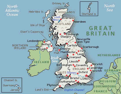
Summary updated Saturday
A
small but active low passed England from southwest to northeast
yesterday; bringing some heavy showers with thunder and hail to many
places. It moved fast east during Friday night and Saturday, to arrive
at Denmark by Saturday afternoon. As the low passes, rain and showers
cleared away, leaving a mixture of bright spells and clouds. However,
the atmosphere is still unstable, and showers can easily form later the
day on Sunday as well as Monday. Scotland, Northern Ireland and
north-western area's of England will see more rain.
However southern regions of the country had some more settlement on
Saturday, as a high spread out over France towards the British Isles.
This high keeps the ocean lows at distance for a while. Not for long
though, as it'll withdraw to the east during Sunday night. With a
south-eastern wind it'll feel rather warm.
A rather active low is developing in Southern
France and moving very fast north during Sunday. Probably
some heavy thunderstorms can develop in the southeast by Sunday
night.
An area of low pressure on the ocean
awaits its chance. It'll move from southwest Ireland northeast to reach
northwest Scotland by Sunday-afternoon. The fronts of this low can
easily reach western parts of Britain. Wales, Western England, Northern
Ireland and Scotland will see a mostly rainy weekend, and are likely to
stay out of the influence of the French high.
Saturday:
is likely to be a dry day for most parts
of England. The western area's have the biggest changes of showers,
sometimes heavy with hail and thunder. Later the day an occasional
thunderstorm can also develop over south and south-eastern
England.
Sunday will
be another unsettled day. Bringing showers; heavy and prolonged to the
western area's. Again, central and eastern parts of England will be dry
at first, but during the day thunderstorms, can
develop.
By
Monday ocean lows dictate the
weather again; it'll be unsettled, rain and showers from time to time.
In the southern area's thunderstorms can develop.
Wind and Weather:
"The sea dashes on in endless
swell" according to a Dutch poet. You can sit and watch
those waves for ever, but this source of imagination is also a subject
of study for marine meteorologists. They are not only occupied
with hurricane-warnings but also with forecasts for wave-height; using
a computer model called WAM (Wave Modeling Group); developed by the
KNMI (Dutch Met office) and specialists from several other
countries. This WAM is published in the book "Dynamics and Modeling of
Ocean Waves" of the Cambridge University Press. It describes
how energy of lower waves can be collected to develop higher waves. The
wind at first causes lower waves that pass on their energy into higher
ones, in a very complicated way. Like a swing gets its movement by
little pushes.
So the
wave height is mainly due to the force of the wind; but also to the
duration of a storm and the depth of the sea.
A near gale (force 7) brings waves of about 12 feet at
the North sea; while during a storm (force 10 and more) the waves can
reach 18 - 24 feet.
The highest waves of the
North Sea ever, were during the storm of February
21 1993. The average height was 24 feet, but there were peaks unto 45
feet. The waves rushed from the Scottish east coast to the Dutch coast
together with the core of the storm. It
stirred up a sort of resonance whereby these rare heights were
reached.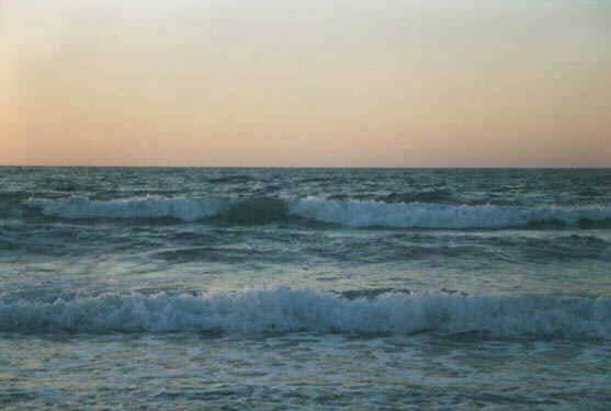
Scotland
England
Wales
N-Ireland
|